
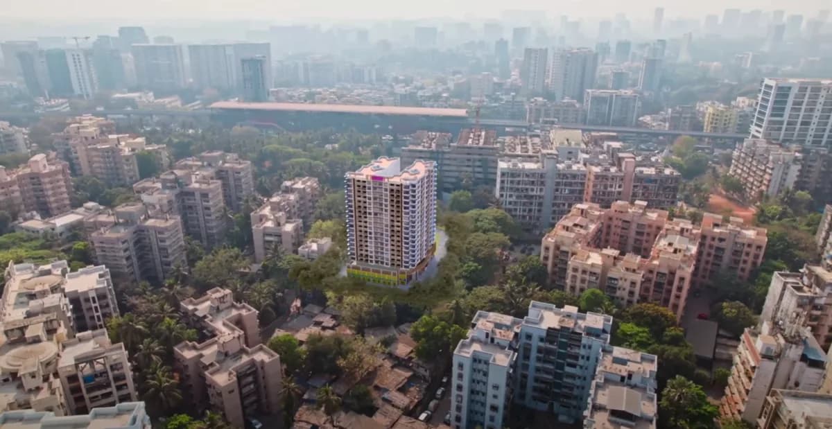
Drone and aerial, India
Real Estate Drone Photography and Video
360 Space provides drone photography for real estate and drone videography services for real estate developers: aerial context, route-to-project films and construction progress. Drone footage can also carry the CGI building before it is built.
- location films
- progress updates
02What it is
Aerial photography for real estate answers the location question: what is near the site, how close are the roads, schools and stations, and what the view will be from upper floors. We film sites for location films, progress updates and aerial virtual tours.
03What it is, continued
Aerial photography for real estate, used well
Drone footage becomes more useful when combined with CGI. We place the rendered building into the real aerial plate, so buyers see the finished project in its actual surroundings. See CGI on drone footage .
We shoot real estate drone videos of the site and its surroundings, and we can combine drone footage with a CGI building so a project that is not built yet appears in its real location.
Drone deliverables
- 01Location and connectivity films
- 02Route to project drone films
- 03Construction drone progress updates
- 04Aerial 360° panoramas and height views
- 05Plates for CGI superimposition
05At a glance
Our drone services at a glance
Drone work falls into three groups: video capture, 360° aerial panoramas and video animation on aerial footage.
Aerial footage of the site and its surroundings, shot to answer the questions buyers ask about location and progress.
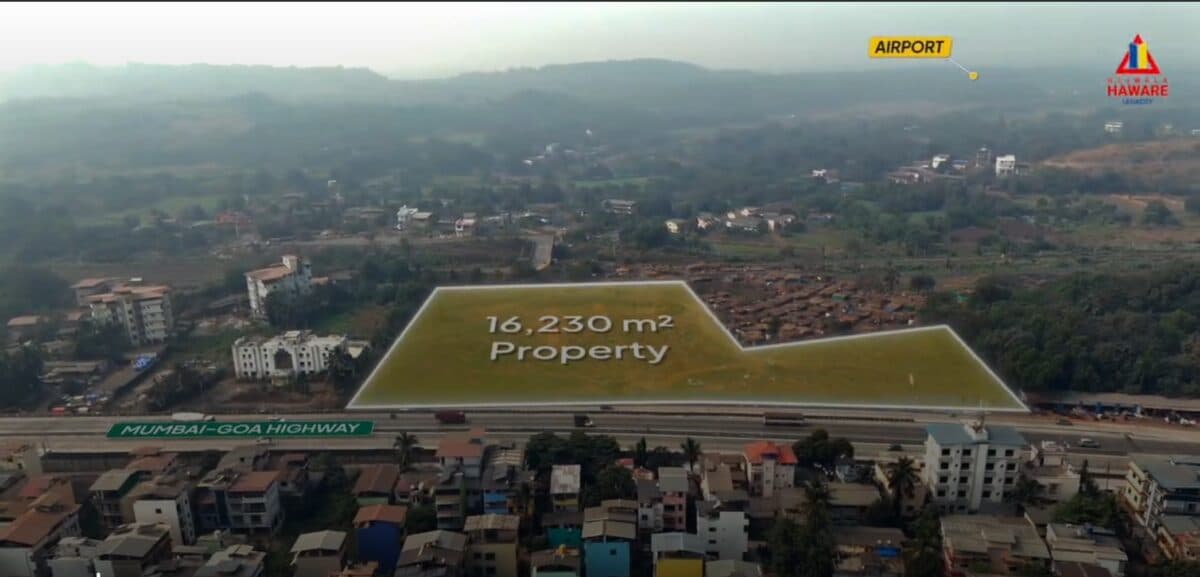
Location film
The plot outlined on aerial footage, with the highway, airport and other landmarks labelled so buyers see where the project sits.
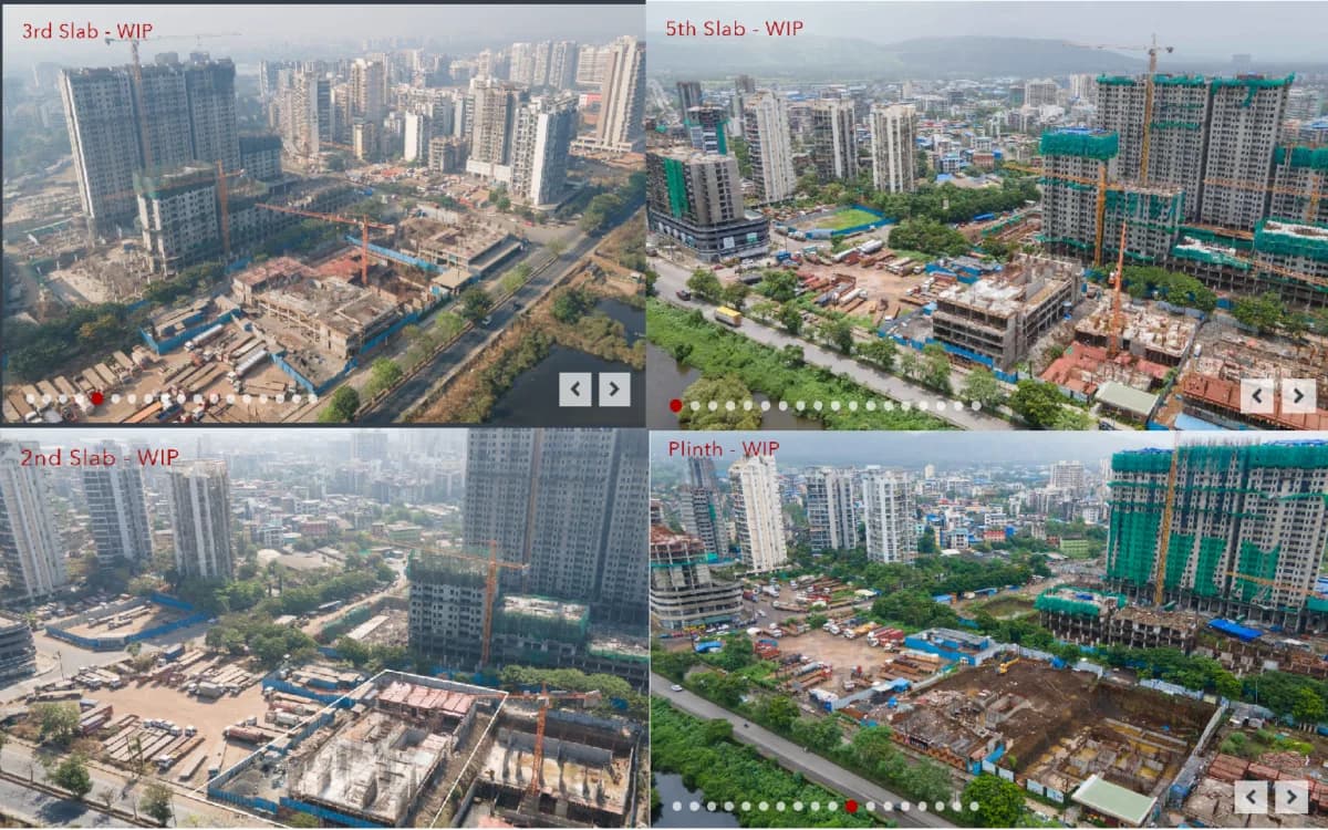
Construction progress
The same viewpoints at plinth, slab and later stages, set side by side so buyers and lenders see progress without a site visit.
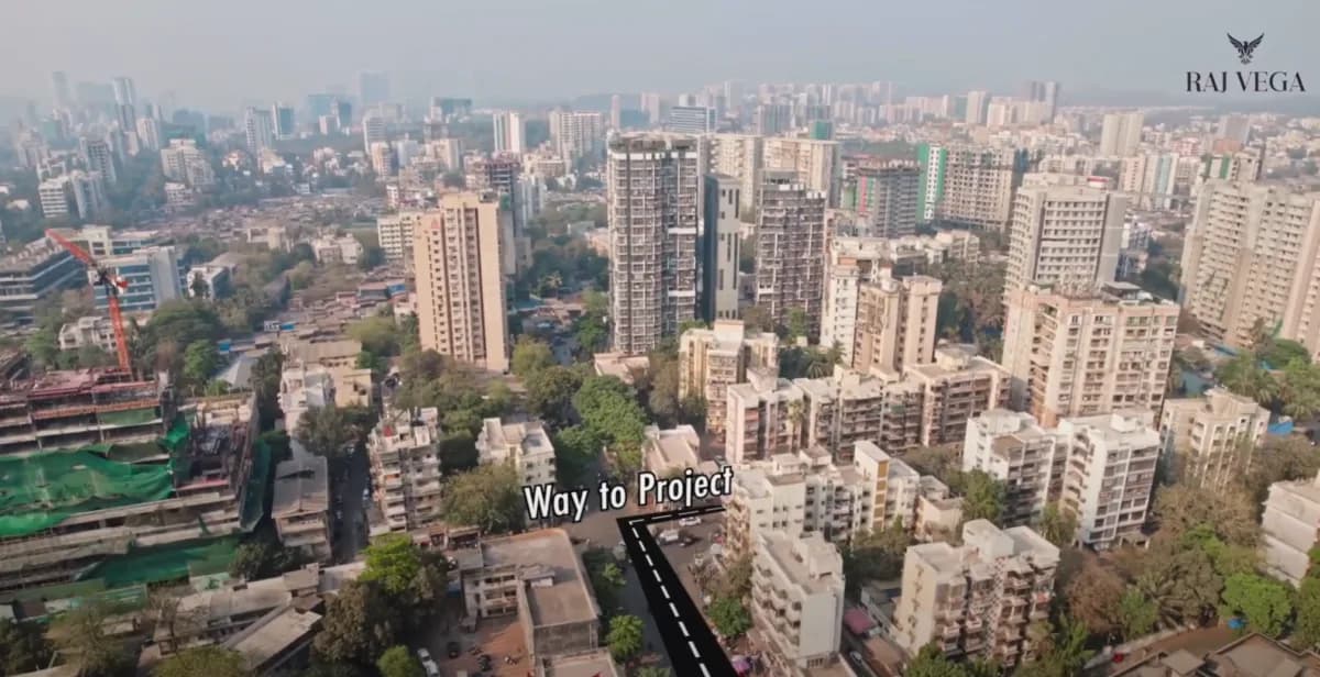
Route-to-project film
A flight that follows the road from a known point to the project, with the route drawn on the footage.
A spherical view from height that buyers look around on a phone, with labels and controls added where the project needs them.
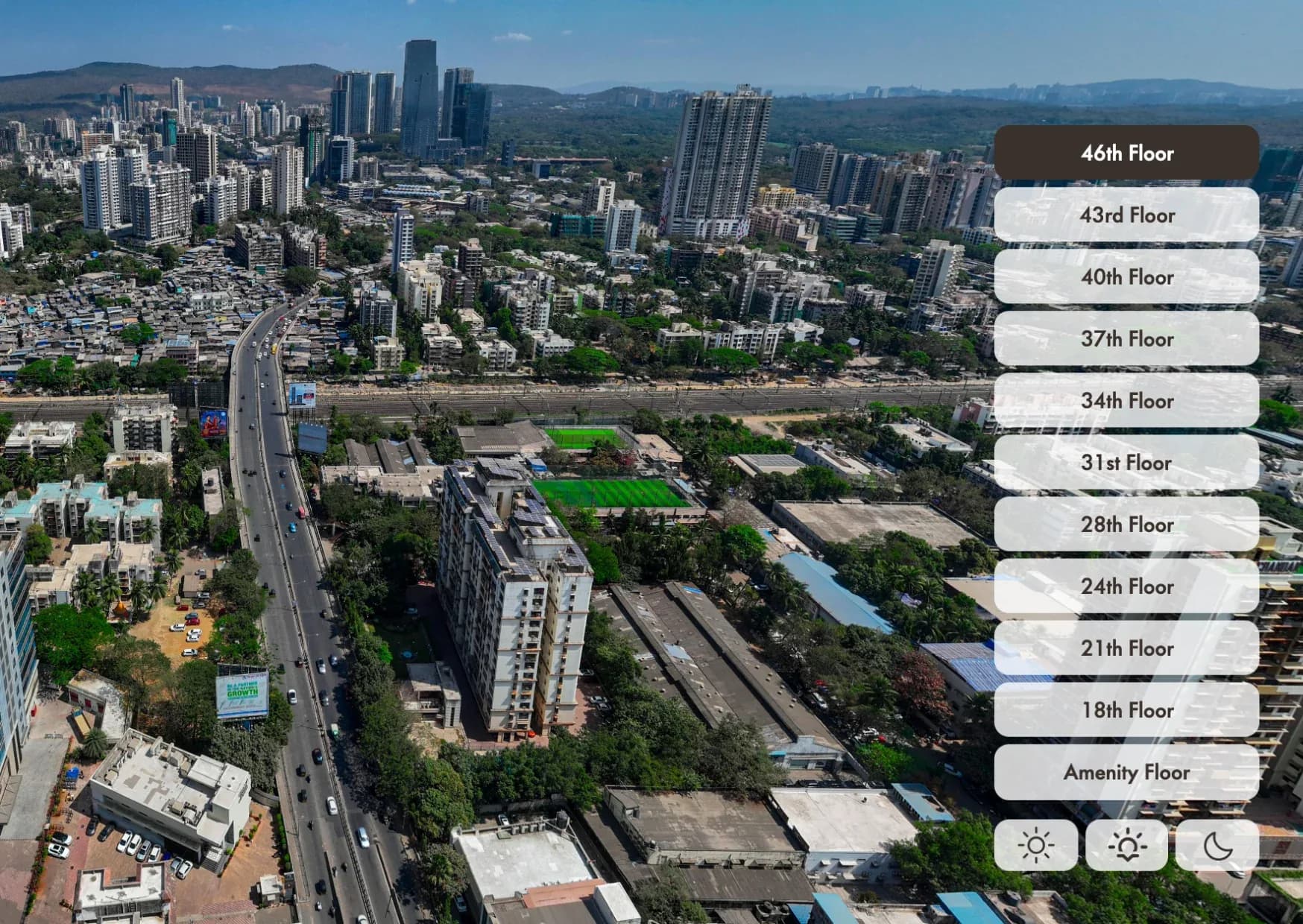
Height views by floor
A panorama shot at the height of upper floors, with a floor selector and lighting controls, so buyers see the view from their own floor.
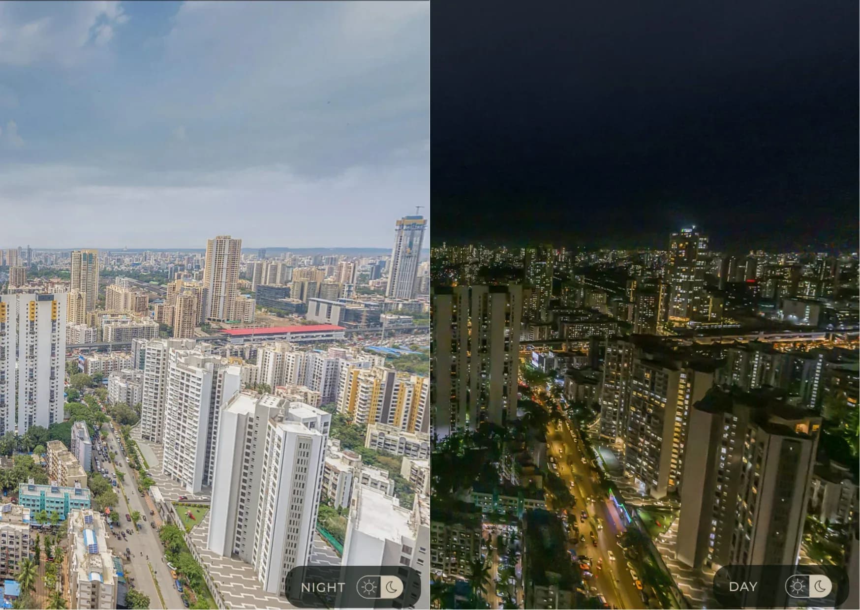
Day and night toggle
One panorama in two lighting conditions, switched with a control, showing the area after dark as well as in daylight.
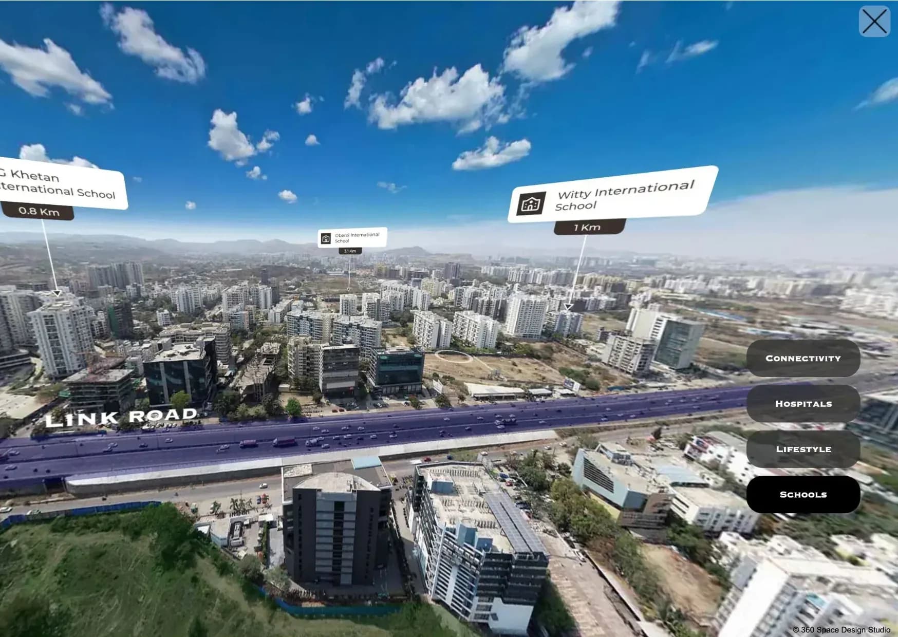
Location advantage panorama
Schools, hospitals, lifestyle spots and connectivity labelled with distances on a live aerial view, grouped by category.
Animation and CGI laid over aerial footage, so the video explains the location and shows the project before it is built.
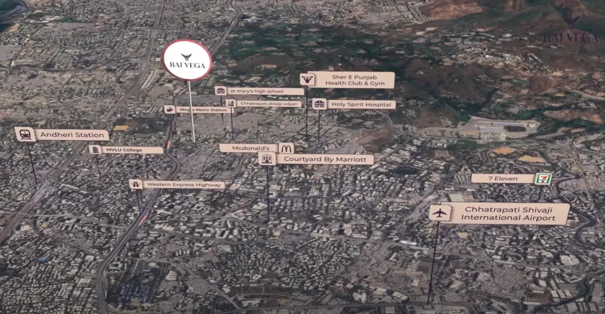
Project location animation
An animated flight over the map to the project, with stations, airports, hospitals and landmarks labelled.
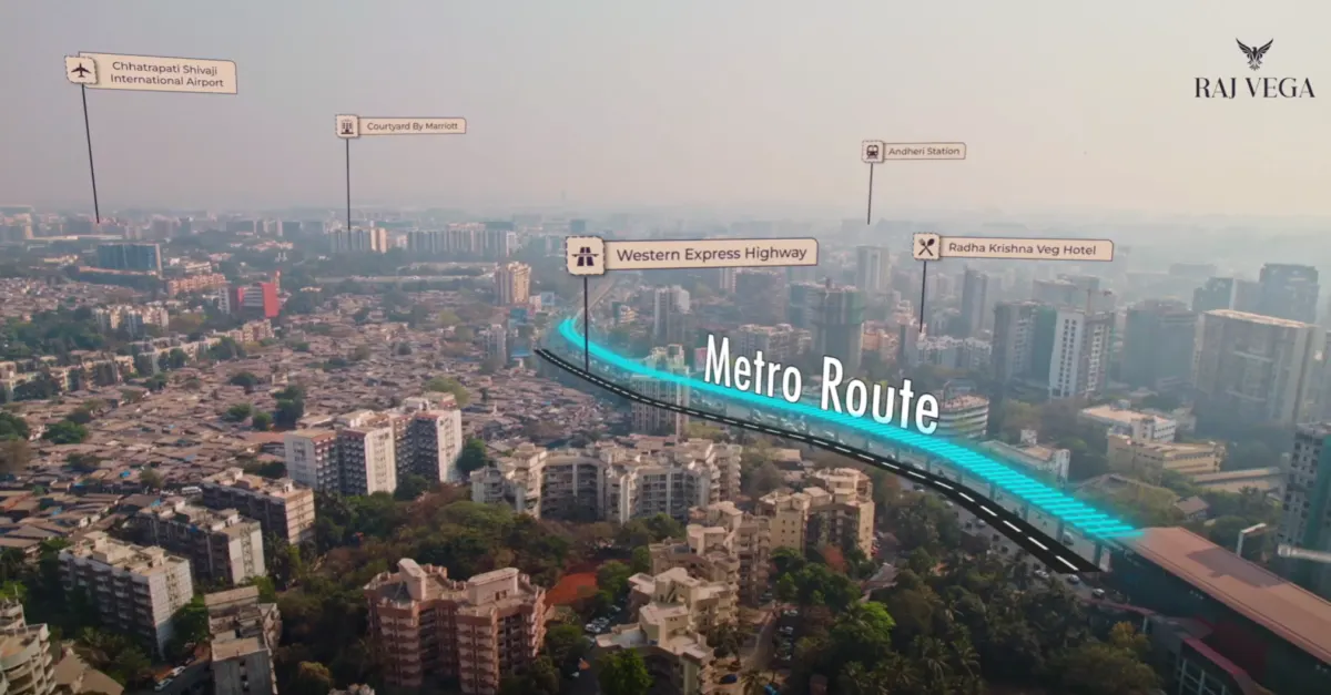
Motion-tracked route overlays
Labels and route lines tracked to the drone footage so they stay locked to the street as the camera moves.
3D project superimposition
The proposed building placed into real drone footage, in its actual surroundings, before it is built.
06In detail
How drone shoots work, in detail
Shot types, planning, progress records, permissions and the three film types, one topic at a time.
01
How a drone shoot is planned, shot and delivered
Site and purpose first, a shot list, one shoot day, then edited delivery.
Planning starts with the site and the purpose. We review the location, confirm the airspace situation and any permissions your project or the area requires, and agree the shot list with you. A recce or map study is done before the shoot day to choose viewpoints and routes.
On shoot day, the team flies the planned shots in suitable weather and light and checks the footage on site, so any gap is fixed before the team leaves. Stills, panoramas and video are captured in the same visit when the brief calls for all three.
Delivery follows editing and colour correction. If the footage will be combined with CGI, it is delivered with the information the CGI team needs to match perspective and light.
What you receive
- Edited film in agreed length and format
- Processed stills for print and web
- Aerial panorama links
- Raw footage where the brief includes it
- Tracking data if CGI will be added
02
Drone shot types and what they are used for
Six shots, each answering a different question. We choose them from your brief.
| Shot | What it shows | Used for |
|---|---|---|
| High aerial | The site against its surroundings | Location pages, investor decks |
| Approach flight | The route from a landmark to the entrance | Route-to-project films, ads |
| Orbit | The building from every side | Launch films, social posts |
| Reveal | A moving view that reveals the building | Film openers, event screens |
| Top-down | Layout, roofs, landscape | Progress records, site plans |
| Panorama | A full 360° view from a fixed height | Aerial tours, location pages |
03
Construction progress drone filming
The same viewpoints each visit, so month-on-month change is obvious.
We film construction progress drone updates for buyers, investors and lenders. A flight from the same angles each time makes change easy to see, and updates can be cut as short videos for WhatsApp broadcasts and buyer portals.
Repeatable flight plan
- Same waypoints each visit
- Same time of day where possible
- Side-by-side comparison frames
- Short update video per visit
| Stage | What matters | Format | Typical interval |
|---|---|---|---|
| Foundation and structure | Visible progress and site safety | Top-down and oblique stills | Agreed with your site team |
| Facade and finishing | Change in the elevation | Orbit film and stills | Agreed with your site team |
| Landscape and handover | Completed look in context | Film and panorama | Once, near completion |
04
Route-to-project and connectivity films
A flight from a known landmark to the site, with what buyers pass labelled.
Location is often the first objection. A connectivity film follows the route from a known point (a station, a highway, a business district) to the site, labelling what buyers pass. The finished building can be added in CGI at the end of the route.
What the film shows
- Route from a known landmark
- Labelled schools, hospitals, malls
- Travel times: only verified figures
- CGI building at the destination
05
CGI on drone footage
The 3D building placed into real video of the site, locked as the camera moves.
We track the drone camera, match light and lens, and place the 3D building on the plot. A photomontage video is the most convincing way to show a building in its surroundings, because everything around it is real.
Site context CGI options
- Building appearing floor by floor
- Day to night transition
- Reveal from a wide aerial
- Labels for landmarks
06
Permissions and safety
Airspace, take-off areas, site rules and a weather backup, settled before a date is fixed.
Flying a drone in India involves rules on airspace, registration and where and when flights are permitted. We check the airspace status of each site before agreeing a shoot, confirm what permissions are needed and work within them. If a site is in a restricted zone or cannot be flown, we say so at the planning stage and suggest alternatives, such as shooting nearby or using a different approach.
Safety on site is part of planning. We agree take-off and landing areas, keep clear of people and traffic, and follow your site rules for construction sites. Shoots are scheduled with a backup day where possible.
Points settled before a drone shoot
- Airspace status and permissions for the site
- Take-off and landing areas
- Site safety rules and access
- Weather and backup date
- Any no-fly or sensitive areas nearby
07
What drone services deliver, and in what form
Film, stills, panoramas, progress updates and CGI-ready footage.
| Deliverable | Used for | Notes |
|---|---|---|
| Edited film | Launch, location and progress films | Cut to length and style |
| Stills | Brochures, web pages, hoardings | Processed for print and web |
| Aerial panorama | Aerial tours and location pages | Interactive link |
| Progress update | Buyers, investors and lenders | Fixed viewpoints, comparison |
| CGI-ready footage | Photomontage and CGI on footage | Steady paths and tracking data |
07FAQ
Questions about real estate drone services
Do you have drone permissions for shoots?
Drone flights need airspace permission for each site. 360 Space identifies what your site needs at the brief and fixes the flight date once permissions are in place.
Can drone footage be combined with CGI?
Yes. We track the drone footage and place the rendered building into it, so the finished project appears in its real surroundings for launch films and location pages.
How often should construction progress be filmed?
Most developers film construction progress at a regular interval tied to their buyer updates, often monthly or at each milestone. 360 Space plans the same flight path each time so updates compare cleanly.
Do you shoot outside Mumbai?
Yes. We travel for drone shoots across India, subject to airspace permissions at each site.
What do you need to plan a drone shoot for real estate?
360 Space needs the site location, the purpose of the footage, the viewpoints or landmarks you want to show and any access or permission details. We study the location, confirm airspace and permissions, agree a shot list and schedule the shoot for suitable light and weather.
Can drone photographs be used as a base for CGI?
Yes. We can place the proposed project into real drone footage of the site, so the surroundings in the image are the surroundings buyers see on arrival. The shoot is planned with the CGI team so perspective, light and camera movement match.
How is progress footage kept comparable over time?
360 Space proposes a fixed set of viewpoints, heights and framings for progress shoots, and repeats them on each visit. This makes the footage easy to compare, and lets buyers, investors and lenders see change over time without needing to visit the site.
Do you deliver stills as well as film from a drone shoot?
360 Space can deliver edited film, processed stills and aerial panoramas from the same shoot day. Which of these you need depends on the brief, and combining them in one visit is usually more efficient than commissioning each separately.
What if a site is in a restricted airspace zone?
360 Space checks airspace status before agreeing a shoot. If a site cannot be flown, we say so at the planning stage and suggest alternatives such as shooting nearby, using a different viewpoint or combining existing imagery with CGI.
How often should progress be filmed?
Most developers film monthly or at each construction milestone. 360 Space plans the schedule around how often you update buyers.
Can you shoot the same angles every month?
Yes. We save the flight waypoints so every update repeats the same angles for clean comparisons.
What does a route-to-project film show?
A route-to-project film from 360 Space follows the journey from a known landmark to the site, labelling nearby schools, hospitals and transport, and ends with the project.
Can you label landmarks and travel times?
Yes. We label landmarks and add travel times when you provide verified figures.
How is CGI matched to drone footage?
360 Space tracks the drone camera movement, matches the lens and sun position, and places the 3D building on surveyed points so it stays locked to the site.
Can the building appear floor by floor?
Yes. We can animate the building rising floor by floor within the real drone footage.
08Keep exploring
Related services and guides
Start a project
Share your drawings, get a scope and quote
360 Space replies with a scope, camera list and timeline. Send CAD, BIM, SketchUp or PDF drawings on WhatsApp or email.